Kati Thanda-Lake Eyre
Tourist attraction and rare ecosystem
Lake Eyre is a large, usually dry salt pan in the South Australian
Outback. Actually, it is Australia's largest salt lake. When it fills
with water, it becomes a major tourist attraction and a heaven for bird life.
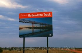
Located north of the Oodnadatta Track in a dry and isolated environment,
the lake was named after Edward John Eyre, the first European who saw
it in 1840. But it was not the "large inland sea" the early explorers
expected to find in Australia's vast interior.
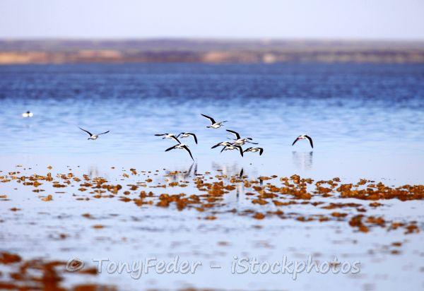 Birds during the rare water events
For the Arabana, the local Aboriginal people living in this remote area, Lake Eyre has always been Kati Thanda. In May 2012 the Arabana have granted a native title over the lake & the surrounding land. So it is quite natural that the official name was changed into Kati Thanda-Lake Eyre in December 2012.
Kati Thanda actually consists of two lakes, L. Eyre North (8 430 km²)
and L. Eyre South (1 260 km²), connected by Goyder Channel which has a
length of 15 km. The dimensions are best experienced from the air.
Flight from Marree and William Creek are available.
The huge salt lake is the terminal point of Australia's largest drainage system, the Lake Eyre basin. The lake is also Australia's lowest point with 15,2 m below sea level in Belt Bay and Madigan Gulf.
On this page you will find
- general facts about the lake system,
- the latest status & water level updates,
- as well as tips on how to get there
- and the necessary safety rules.
Remember, this is a remote and harsh desert area, good preparation is essential.
Click on the links to jump to the topic that interests you most. But there is much more when you read through the entire page. Explore an unique and fascinating natural attraction in the South Australian Outback with me.
Kati Thanda-Lake Eyre Facts
Where does the water come from?
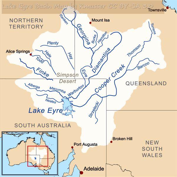 The huge Lake Eyre drainage basin
The main tributaries into the lake are the rivers in south-west Queensland, the Diamantina and Georgina river systems and Cooper Creek.
Although these rivers flow quite frequently, they hardly reach Lake Eyre
every time they carry water. High evaporation, and the fact that the
rivers fill many channels along their way to the lake, make it hard to
predict whether or not they'll reach their final destination. Cooper
Creek usually terminates at the Coongie lakes wetlands north of Innamincka.
After one of the most devastating floods in 1990, Cooper Creek reached
the lake for the first time in more than 20 years. It took another 20
years until the Cooper made it to the lake again.
Western tributaries are the Neales and Macumba rivers.
In 1984 and 1989 the western tributaries filled Lake Eyre South within a
few days. Finally, the water overflowed to Lake Eyre North. This is
recorded a very rare event, as usually the northern lake fills first,
and overflows the southern part.
It is a fact that Kati Thanda had only filled to its full capacity
three or four times within the last 150 years. Of course, minor fillings
are recorded every couple of years. How much water is in the lakes can
be only judged from the air. Satellite images give fairly clear
information about water levels in the lake.
Any news of water in the lake gets locals, travellers and tour operators
most excited. It is a well deserved increase of popularity and business
in this remote area. Local air charters to fly over Lake Eyre are
available from Marree and William Creek.
Remember, this is such a remote area, and public access is only through a two public access routes (PAR), departing from the Oodnadatta Track. You can't just drive
out and see if the lake holds water on a Sunday afternoon :).
If you ever travelled along the Oodnadatta Track and detoured to Lake
Eyre, you know this is a harsh and dry land. Beautiful, nevertheless.
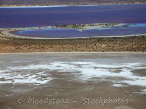 Water flowing into the lake
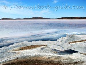
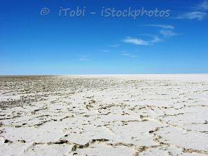 A dry salt crust on the surface
Lake Eyre Basin
The basin covers more than 1 million km², or 1/6th of the continent,
mainly in Queensland, South Australia and the Northern Territory.
Globally, it is one of the largest internal drainage systems.
It is a closed drainage basin. This means there are no outflows to
external rivers and seas. Look at the above map, can you imagine the huge distances water has
to flow to reach L. Eyre? However, when you travel out there, you won't
see much water most of the times.
But... when the water flows once every couple of years, it
is a sensation for locals and travellers alike. It is amazing to see
the changes in this dry and harsh land.
Would you believe there is even a local yacht club sailing the inland sea then?
Lake Eyre yacht club has its clubhouse and headquarters in Marree. And yeah, they are thrilled every time when water is in the lake.
The club supports those who want to take their own boat onto the lake, and they hold boating events, circumstances permitted.
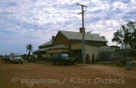
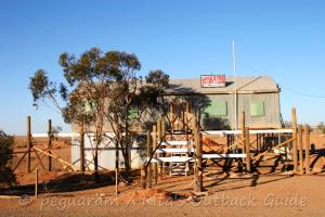 Headquarters of the sailing club
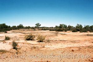 The wide bed of Cooper Creek
Recent water events
- After major flooding in western Queensland early 2010 there is another
flow into Lake Eyre North. Local rain in the area put some water into
the southern lake.
- November 2010: Now that summer has arrived to the
Australian Outback evaporation becomes greater than water inflow.
Warburton Creek is a trickle, the flow into the lake is going to stop
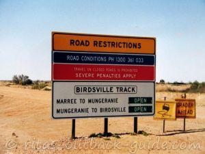
soon. Cooper Creek is still cutting the Birdsville track and flowing
into Madigan Gulf.
- January 2011: Evaporation is high, right now there is
less than 35% water coverage. However, the rivers feeding Lake Eyre have
still water, and rain in Qld will probably bring more water down the
Cooper.
At the end of the month the ferry stopped its operation, you can now cross Cooper Creek on the Birdsville Track. - March 2011: More rain drenched the north-east of
South Australia and south-west Queensland, resulting in rising water
levels in Lake Eyre. Winter 2011 saw even more water in the lake than
2010.
- February 2012: L. Eyre is nearly dry, there is
only about 5% water remaining. The latest floods in south-east Queensland
won't have much impact on the water levels in the lake.
- March 2016: The lake is thinly covered with water, the water levels in Belt Bay are rising.
- March 2019: After the devastating February floods in the northern Diamantina catchment, water is on its way to Kati Thanda. Actually, it has reached the Warburton river, and it is moving fast.
- May 2019 - More rain events happened in the Lake Eyre catchment, not as devastating as the first one in February. Much of the water will be soaked by the dry soils, but there is water flowing towards the lake.
It is expected that the lake might fill two-third, or even three-quarters, by June. This would be the best flood year since 1974, when Lake Eyre was considered to be full the last time. - Click here to check the current water levels of Lake Eyre and the rivers. (Kindly provided by the above mentioned yacht club)
I will post updates when major changes happen. You can always use the above link to check if there is any water flowing into the lake.
Kati Thanda-Lake Eyre National Park
Important Visitor Information
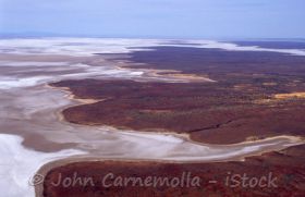
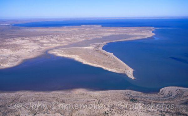 Aerial view of Kati Thanda-Lake Eyre with water
L. Eyre National Park covers an area of 13,000 km². It is a stark wilderness, an ancient landscape that is very hard to access.
Vegetation in this part of the Australian Outback is usually sparse. Creeks are lined with salt bush and acacias.
However, vegetation can burst into a blaze of fresh green and wildflowers after local rains.
It is also amazing to see large flocks of water birds migrating to the lake once there is some water.
I always wonder how the birds "smell" the water!
How to get there?
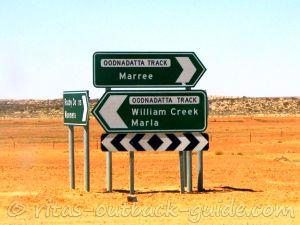
Access to the lake and the national park is either from Marree or William Creek.
Near Curdimurka, the Oodnadatta Track comes very close to the shores of Lake Eyre South. There is a car park where you can catch a glimpse of the lake.
You are not allowed to walk out to the lake from here as this is station property.
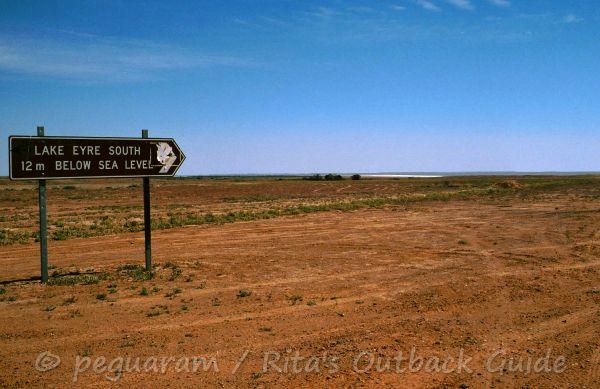 Sign pointing to Lake Eyre South
Getting to Lake Eyre North
Level Post Bay Track is a public access route from Marree to
Muloorina homestead and further to the shores of the northern lake.
Camping is not allowed on the shore, but there is a campground at
Muloorina water bore.
The total distance from Marree to the lake is 100 km. About 20 km past
Muloorina you reach the shores of Lake Eyre South, and travel along
Goyders Channel to the northern lake.
Halligan Bay Track is the second public access route to the lake
starting 7km south of William Creek. This is a 64 km track via Armistice
Bore and ABC Bay to Halligan Bay. There is a basic campground with
toilets.
Permits
Visiting Kati Thanda-Lake Eyre National Park requires a desert park pass, or an entry / camping permit. Both can be obtained in Marree and William Creek.
If you plan to visit multiple national parks in the South Australian
Outback, it is worth to purchase a desert park pass which is valid for
one year. The pass comes with a package of maps and a booklet with
valuable information about safe travelling in the Outback, and
information about flora and fauna in each park.
The Halligan Bay public access route and the campground are closed for safety reasons from 1st December to 15th March.
Safety Advice
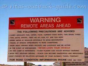
Please be aware that the routes to the shores of Lake Eyre cannot be
compared with travelling along the Oodnadatta Track. You are going into
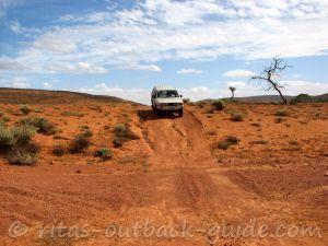
very remote country, and track conditions can be quite challenging.
A 4WD vehicle with high clearance is required, and you should know the
car, know how to use the 4WD properly when conditions get rough.
Camper trailers are not recommended, don't even think of towing a caravan to the lake's shores!
Take a HF radio or satellite phone with you, or at least a UHF radio.
Contact William Creek via UHF Channel 4 and Marree via Channel 7 when
you get in trouble. Carry plenty of water, and avoid these tracks during
the summer months.
As always: Never leave your vehicle when you are in trouble. Someone will finally find you.
Caution: Please do never drive on the lake surface. It is
an offence, and it is dangerous. Even if the surface looks firm and dry,
you might get bogged in the mud if your car crashes through the salt
crust (which is rather thin in places).
Oodnadatta Track -> the route step by step
Don't miss the articles below which give you many more details about the route.
Get general facts, an introduction and overview of the track (617 km)
Discover the history of the early days in this fascinating town
The first section of the Oodnadatta Track is in my
opinion the most diverse part of the track (204 km)
This small town offers everything a traveller needs. You'll be surprised
what you'll find in this tiny village
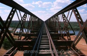
See more relics of the Old Ghan, including the huge Algebuckina railway bridge (202 km)
First discover the township Oodnadatta, before you go on the last leg of the track (211 km)
Don't miss to read this page, it also includes useful tips by Outback Guide readers
Read about Australia's largest lake which only fills every couple of years
Find camp spots, where to get fuel, a good meal, and a cold beer
Outback South Australia is a wonderful place to explore, don't miss it
Enjoy this most interesting (and my favourite) track in the South Australian Outback.
Below you'll find more useful articles to help you plan your journey.
- Home ›
- Oodnadatta Track ›
- Lake Eyre
