Map of Australia
View maps online to start planning
Buy the best maps for your Australian Outback trip
What do you need to plan a trip to the Australian Outback? Yes, a map of Australia! Of course, because Australia is such a huge country, a general Australian map won't show many details.
The Australian map pictured below is for a general overview. The red square roughly covers the eastern Outback areas, and the regions described in Rita's Outback Guide.
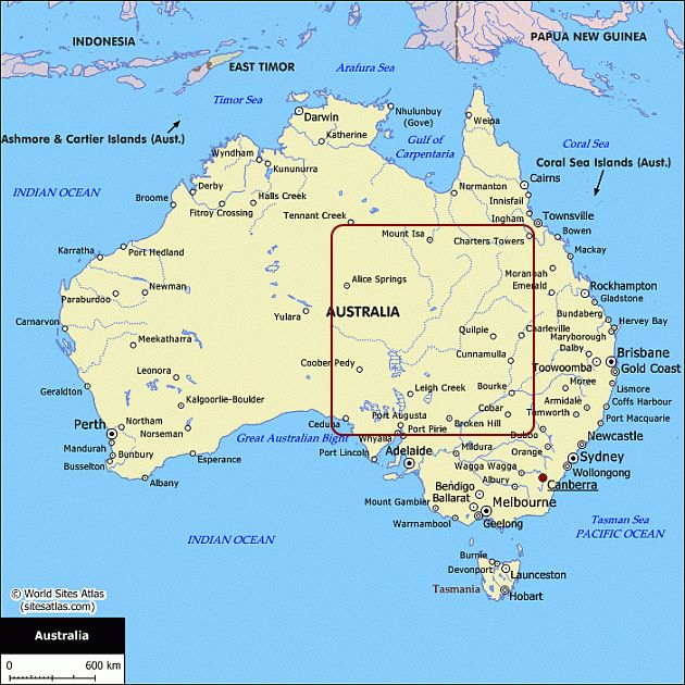
You see on that map that the south and east is more populated than the inland. But of course, there are more towns in the inland, they are just so tiny that they don't appear on that map.
I will do more research on detailed maps of Australia for each region described in the Eastern Outback Guide, promised!
Capital Cities
Accommodation
Special Interests
- General Facts
- Australian States
- Photo Gallery
- Climate & Bushfires
- Australian Wildlife
- Australian Opal
Rent A Campervan
Online Map Resources
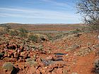
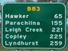
Meanwhile, use the links below to check out fairly good maps of the Oodnadatta & Birdsville Tracks, and the Flinders Ranges. These links open a new browser window for your convenience. You can frequently check the maps while you read about these areas in the Outback Guide.
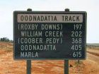
Map of Oodnadatta Track
Map of Birdsville Track
Map of Flinders Ranges
Recommended Maps For Your Outback Trip
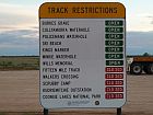
Here I am going to add some recommendations to buy the best maps to take with you on your trip. Especially in the Outback it is good to have a map that shows you where you can get fuel, where to find a great campsite and what the road surface is like.
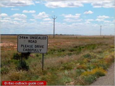
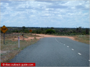
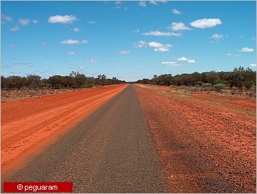
Since my first driving tour to the Outback I saw quite a few changes. Roads that where completely unsealed 20 years ago have improved.
If it is a long stretch between towns, you will also notice that a few kilometres of bitumen will be followed by a couple of kms of rough road. sometimes it takes years until a road is completely sealed.
That's why it is a good idea to have always the latest edition of a map or road atlas because you then know what the conditions are like on your journey.
In my opinion, HEMA has the best maps with heaps of additional information. You can buy them easily online at Traveluniverse.
Click the image below to see a list of maps & road atlases. I am sure you will find an appropriate map for the region you want to travel in Australia.
Highly recommended
Australia Touring Atlas is a handy spiral bound road atlas.
The touring atlas has the most comprehensive road details. Included are city maps, national parks, fuel stations, Outback roadhouses, camping areas and many more tips to get you to your destination.
The Great Desert Tracks Atlas
You can't decide yet where to go in the Australian Outback? The Great Desert Tracks Atlas covers all of inland Australia and includes all six maps of these great series.
So why buy each map solo, when you get them all with this guide book? It saves you a lot of money.
The Great Desert Tracks Atlas and Guide includes as an extra maps of The Pilbara and midwest regions of West Australia and the Coral Coast. Plus desert driving tips, guides to plants and animals and much more useful info.
Australian Roads