Outback New South Wales
Back O' Bourke, Darling River & Corner Country
Wide open spaces, rugged rocks, sandy plains with mirages, deep-blue
skies, diverse wildlife, unique pubs and historical places await you in
the Outback New South Wales.
But wait! The far west of NSW is not all red earth and dust!
 Landscape in the far west
The majestic Darling, Australia's third largest river, meanders through
Outback NSW on its way to meet the Murray river in Wentworth. So don't
forget your fishing rod when you head out there!
Come on! Pack your car and discover a stunning region. Outback
New South Wales has a lot in store for adventurous folks and also for
those
who prefer a little comfort during their travels. You will enjoy it!
Outback New South Wales - Table of Content (TOC)
- Where do I find the Outback, is it easy to reach?
It is way out west, a fascinating wilderness with national parks and unique towns
Routes and attractions in a south-north direction
- Silver City Highway
From Buronga to the Qld border - Cobb Highway
Deniliquin & Hay to Wilcannia - Kidman Way
Jerilderie to Bourke
Routes and attractions in a east-west direction
- Sturt Highway
Hay - Balranald - Buronga - Barrier Highway
Nyngan to the South Australian border - Wanaaring Road
Bourke to Tibooburra - Darling River Run
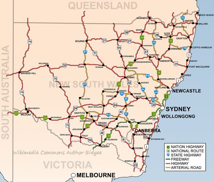
From Bourke to Wentworth - Look at the map on the bottom of this page to get an overview
(right-click and open in a new tab/window for convenient planning)
Where is the Outback in New South Wales?
The far west of the state which borders to South Australia in the west and Queensland in the north is called the Outback. You can roughly say the area west of the Mitchell Hwy (B71) and the Kidman Way (B87) belongs to the dry and lonely back country.
However, there is no
noticeable border, so the western parts of the Orana region (the shires
of Bourke, Cobar, Brewarrina) certainly can be considered Outback as
well.
The Sturt Highway (A20) from Buronga to Hay marks the southern boundary.
 Unsealed patches of the Silver City Highway north of Broken Hill
Outback NSW can be reached on major highways from the
east coast. Bourke, Broken Hill, Silverton, Menindee, Cobar &
Wilcannia, Balranald & Hay... drive on good bitumen roads to these unique cities &
towns.
Several national
parks and nature reserves wait to be explored by the keen bush walkers.
Discover Aboriginal cave art, stunning features of nature, historic
homesteads and sheering sheds.
Silver City Highway (684 km)
This is the westernmost route that leads you from the irrigated vineyards at the Murray River to Broken Hill and further north to Tibooburra and the Queensland border. The road starts in Buronga, at a roundabout, where it branches off the Sturt Highway. There are a couple of short unsealed sections north of Broken Hill, otherwise, it is a good bitumen road all the way
Attractions along the way
- Confluence of the Darling and Murray Rivers in Wentworth
- Great Darling Anabranch, an 460 km ancestral path of the Darling river
- Broken Hill is the major centre in the far west. It is a wonderful place to enjoy city life before (or after) a major journey into the loneliness
- Silverton and the Mundi Mundi Lookout - The
famous Outback ghost town has attracted artists and film makers.
Actually, it is not a real ghost town, the famous pub, galleries and the
tea rooms offer services for visitors.
Don't miss the Mundi Mundi lookout a few kilometres out of town. If possible visit for a sunset experience, it is awesome! - Explore the history of the Corner Country, Milparinka, Tibooburra and Sturt National Park.
- Visit Cameron Corner, where three states meet
 Sunset at the Mundi Mundi lookout near Silverton
Cobb Highway (610 km)
This road is named after the Cobb & Co coach company. It is part of a heritage touring route called the Long Paddock, a tourism initiative founded by the towns along the way. Discover the history of Deniliquin, Hay and Ivanhoe, laid-back rural towns far away from the busy cities.
The Cobb Hwy is 610 km in its entire length from Echuca in the south, to Wilcannia. North of Ivanhoe begins a 135 km (approx.) unsealed section that is a dry weather road.
D(r)ive back into history, when drovers moved large cattle herds on the stock routes in this part of the country.
Kidman Way (644 km)
 Kidman Way between Cobar and Bourke
You might say the above photo doesn't look much like Outback. It certainly is a lonely route. We were lucky to visit this part of the country after a series of good rain, so bushes, trees and wildflowers were looking fresh and green.
The Kidman Way branches off the Newell Highway north of Jerilderie. It connects the Murrumbidgee irrigation areas in the south with Outback towns further north.
It follows old stock routes which linked the huge cattle stations, many of them were owned by the "cattle king" Sir Sidney Kidman.
The Kidman Way is fully sealed. Be aware that there is a long stretch of 260 km without fuel between Hillston and Cobar.
Sturt Highway
 Between Balranald and Hay - Sturt Hwy
This is the shortest connection between Sydney and Adelaide. The Sturt highway follows roughly the route of the Murrumbidgee River, it is the southern boundary of what is considered the Outback in NSW.
Although the Riverina region is well-known as a productive agricultural area, and you see lush towns, this wouldn't be possible without the water supply and irrigation.
When you travel from Narrandera to Hay, Balranald and Buronga, you'll see a lot of dry salt bush on the flat plains outside the irrigated areas. The climate is hot and rainfall is scarce in these south western parts of Outback New South Wales.
Take your time for a detour to Mungo National Park and the Walls of China from Buronga. This 115 km drive takes you from the lush orchards on the Murray River along Arumpo Road to the heart of an ancient landscape. Buried in layers of clay and sand, the stories of this ancient land and their people, can be read.
Barrier Highway
Travelling along the sealed Barrier Highway gives you a real Outback feeling. The highway starts in Nyngan, and heads west to Cockburn near the South Australian border. The length of the route in New South Wales is about 630 km. The road traverses very remote country, towns and roadhouses are few and far between.
Attractions along the way
- Cobar is a mining town with some interesting brick-built heritage buildings and churches
- Go digging for opal in White Cliffs, who knows, you might make a fortune! 73 km detour from Wilcannia on the fully sealed Opal Miners Way
- Wilcannia was once the third largest inland river port, and there are impressive brick buildings to explore. It is a sad sight to see hardly any water in the Darling River these days.
Wilcannia has been struggling with a bad reputation for years. I never had any problems during my visits. I read that things are changing to the better now, since the locals try to attract tourists to this historic town.
Click here to read about the entire tour along the Barrier Highway, from Nyngan to Giles Corner in South Australia. It is a worthwhile Outback journey on a sealed road.
 Near Little Topar Roadhouse - Barrier Hwy
It is usually very dry along the Barrier Highway. However, after some good rainfalls in spring 2010, there was a lake near Little Topar Roadhouse
Wanaaring Road (426 km)
This unsealed dry weather road takes you from Bourke to Tibooburra via Wanaaring. It is a long and lonely drive through true Outback country.
Fuel and supplies are available in both towns at each end of the route, and in Wanaaring, which is about half-way between.
Recently work has been in progress to seal the Bourke to Wanaaring part of the road, about 80 of 195 kilometres are now completed (2019).
Darling River Run (720 km)
 Post office in Bourke
These days it is easy to discover the location of the post office
Discover the history of
the old river ports on a tour from Bourke to Wentworth, where the
Darling river joins the mighty Murray.
The route along the Darling River is a dry weather gravel road, actually, there is a road north and south of the Darling. You can cross the river in Louth, Tilpa, Wilcannia and Menindee.
Check at either end (Bourke or Menindee) which road is in better condition. From Menindee there is only one road to Pooncarie, but then you have the choice of two roads again. The eastern route from Pooncarie to Wentworth is even fully sealed.
 Sadly, the Darling doesn't hold so much water any more these days
Road conditions and supplies
Fuel & Supplies
Roadhouses and towns offer basic supplies and fuel along the roads.
There is usually no need to carry extra fuel. However, remote places
might be in short supply of fuel after a rainy period. That is to say
when the fuel truck doesn't get through on wet roads.
Road conditions:
Many towns can be reached on good bitumen roads, while other destinations might require a 4WD. Roads might be closed after rain.
Before you go, please check road conditions online or call RTA 132701, NSW western regions 80826660, and always check the weather forecasts.
I hope you enjoy these beautiful places in Outback New South Wales as much as I do. Come back frequently, I add more stories from my travels in this stunning country.
Discover destinations in the far west of NSW

Explore famous places like Silverton, Corner Country, Menindee Lakes and the Darling River

The only city in this part of NSW has a lot to offer. Stay a few days to discover all attractions

Visit the one of the remotest stores in the Australian Outback

A town with lots of character and the stunning Mundi Mundi plain

See ancient mountains, open plains, glistening salt lakes

Discover history & tales along the Matilda Way
The articles below help you to plan your journey


- Home ›
- New South Wales - The far west
Travel Advice during Sars-CoV-2 Outbreak

Do you plan to travel to, or within Australia? Restrictions apply due to the Covid-19 pandemic.
Please click here for the latest travel advice from the Australian Government.
Don't miss these popular articles


Connect And Follow Our Tracks
Please join me at Facebook & Twitter
![]()
![]()
![]()
![]()
Legal Stuff
ALL RIGHTS RESERVED